M@TE
ModelsPeopleSearch
Github

1 post tagged with “Deltaic depocenters”

    Our simulations produce catchment areas, river lengths, and volumes of deposited sediment that are consistent with the ranges observed in continental-scale deltas such as the Mississippi and Amazon rivers. (a) Example showing the outputs from the numerical simulation showing the elevation and bathymetry (top) and cumulative flexure (bottom). Model dimensions are 4500 km x 2000 km, with a vertical exaggeration of 100x. (b) Scatter plot of river length (top) and 405 shelf width (bottom) versus catchment area from river systems. Data is from Somme et al. (2009), Nyberg et al. (2018), Blum et al. (2013, 2017) and simulations presented in this study. Pal= Paleocene, Oli=Oligocene, PM= Paleo-Mississippi. (c) Example of synthetic stratigraphy from a simulation without (left) and with flexural compensation (right).

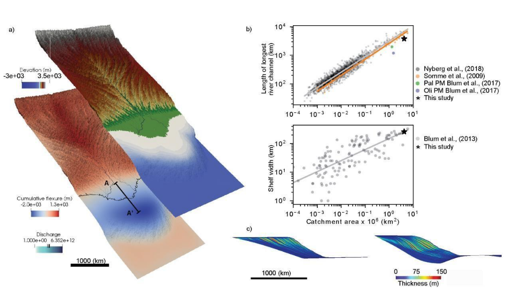
    Flexural isostatic response of continental-scale deltas to climatically driven sea level changes

    Uploaded by: Sara Polanco

    Uploaded: May 24, 2024

    Software: Badlands

    Tags:

    Deltaic depocentersFlexural isostasyGlacial isostatic adjustment (GIA)Stratigraphic record

Browse all tags

  • Home
  • Project Info.
  • Contact
AuScope Logo
Funded by AuScope
Copyright © 2020-2023 AuScope. All rights reserved.