Constraining the response of continental-scale groundwater flow to climate change
Constraining the response of continental-scale groundwater flow to climate change
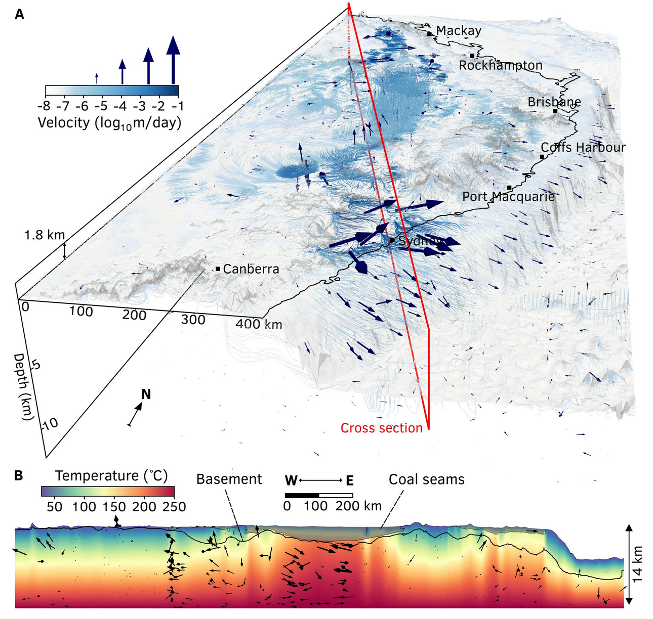
This model was developed in order to study groundwater flow on a continental scale, focusing on the Sydney–Gunnedah–Bowen Basin in Australia. Using data such as hydraulic head measurements and borehole temperatures, it predicts how water moves through deep aquifers to the surface. Coastal aquifers show fast water flow, while inland aquifers have much slower flow. The study shows that increased water extraction from inland areas could permanently change water flow patterns. This open-source model can be used for other regions and aims to support sustainable groundwater management policies
Research Tags
Associated Publication
Constraining the response of continental-scale groundwater flow to climate change
Ben Mather, R. Dietmar Müller, Craig O’Neill, Adam Beall, R. Willem Vervoort, Louis Moresi
DOI10.1038/s41598-022-08384-w
Abstract
Numerical models of groundwater flow play a critical role for water management scenarios under climate extremes. Large-scale models play a key role in determining long range flow pathways from continental interiors to the oceans, yet struggle to simulate the local flow patterns offered by small-scale models. We have developed a highly scalable numerical framework to model continental groundwater flow which capture the intricate flow pathways between deep aquifers and the near-surface. The coupled thermal-hydraulic basin structure is inferred from hydraulic head measurements, recharge estimates from geochemical proxies, and borehole temperature data using a Bayesian framework. We use it to model the deep groundwater flow beneath the Sydney–Gunnedah–Bowen Basin, part of Australia’s largest aquifer system. Coastal aquifers have flow rates of up to 0.3 m/day, and a corresponding groundwater residence time of just 2,000 years. In contrast, our model predicts slow flow rates of 0.005 m/day for inland aquifers, resulting in a groundwater residence time of 400,000 years. Perturbing the model to account for a drop in borehole water levels since 2000, we find that lengthened inland flow pathways depart significantly from pre-2000 streamlines as groundwater is drawn further from recharge zones in a drying climate. Our results illustrate that progressively increasing water extraction from inland aquifers may permanently alter long-range flow pathways. Our open-source modelling approach can be extended to any basin and may help inform policies on the sustainable management of groundwater.
Compute Tags
None specified.
Software
Software information not available.
Model Setup
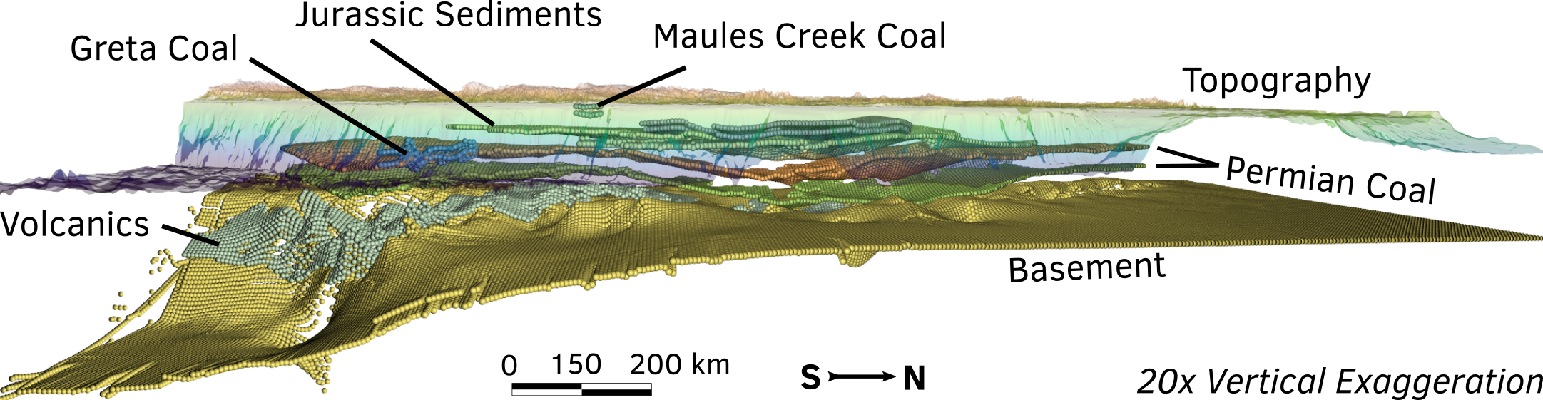
3D stratigraphy of the Sydney–Gunnedah–Bowen Basin. The vertical spacing of layers has been exaggerated for visual clarity. The model of the basin was rendered in 3D using Underworld.
Dataset (NCI catalogue):
https://thredds.nci.org.au/thredds/catalog/nm08/MATE/mather-2022-groundwater/catalog.html
Dataset existing identifier:
10.25914/t2mn-bk81
Dataset notes: model_output_data contains the following file types: .h5 - Underworld2 data files .xdmf- Underworld2 xdmf header files .csv - Various data in csv format .npz - data on numpy binary format .png - image files .pvsm - Paraview state files .txt - data in .txt format
Model files (NCI catalogue):
https://thredds.nci.org.au/thredds/catalog/nm08/MATE/mather-2022-groundwater/catalog.html
Model files existing identifier:
https://github.com/brmather/Sydney_Basin/tree/master
Model files notes: Code and inputs for computational model
Source repository:
https://github.com/ModelAtlasofTheEarth/mather-2022-groundwater
Citation
Mather, B., Müller, R. Dietmar., [O’Neill, O’Neill], C., Beall, A., Vervoort, R. Willem., & Moresi, Louis. (2024). Constraining the response of continental-scale groundwater flow to climate change [Data set]. AuScope, National Computational Infrastructure. https://doi.org/t2mn-bk81
Licence
Funders
- NSW Department of Industry
- AuScope